 Grand Lake's sister in the Himalayas.
Scroll down for more images and the story. Click on a photo for mists.
Click here to jump to Mountain Lake Properties opening screen ... to Weather ..
.. Homes .. Land .. Commercial opportunities .. to Scenery .. to Bhutan.
Grand Lake's sister in the Himalayas.
Scroll down for more images and the story. Click on a photo for mists.
To appreciate and comprehend Grand Lake, one could seek its twin elsewhere.
We recently had the opportunity to do just that on the other side of the globe,
deep in the Himalayas of eastern Tibet. We had free airfare to Beijing through
our business's Visa miles. The rest, we put together by following our nose to what
appears to us to be Grand Lake's sister village in the Himalayas.
The distance traveled was great, but not that difficult, and not so different
from what is endured by the occasional Chinese and Japanese visitors to
Grand Lake Village.
These nationalities made their way to Grand Lake long ago as hardy laborers
in the digging of the Grand Ditch that cuts hard across the Never Summer
Mountains and diverts a prodigious amount of snowmelt into the Cache de la
Poudre Stream. There is some confusion in the historic record as to whether
these laborers were Japanese or Chinese.I digress here a bit because in our travels,
we were often asked if there were Chinese or Tibetan people living in our town.
For current times, we could do little more than point to the owners of the Pearl Dragon
restaurant in Granby.
As many know, in the summertime, one can get to Grand Lake by driving the spectacular
Trail Ridge Road over and through Rocky Mountain National Park. This road is snowed-in
and closed from October to May. The year-round route is via Highway 40 and then taking
the turnoff onto Highway 34 that ends near Grand Lake. The scenic drive to the natural
waters of Grand Lake passes two large and beautiful lakes that popped into existence
in the early 1950's to dam water for irrigation and to create hydroelectric power.
We mention this because at the sister lake we found in the Himalayas, all of these
similarities are present, except that with the Himalayan area, there is a time lag of
about 60 years. At the bottom of this page, we will show some of the views as one
approaches the lake. To bypass all of this introduction, just click on a photo and
you'll see the lake in one of its visionary moods. Click again and you'll see the
lake and its surroundings at dawn. On the last page of this presentation there is a
bit on the logistics of getting around Tibet and geopolitics.
Before there were interstate highways, Highway 40 was a paved two lane road from
Atlantic City, New Jersey to Park City, Utah and in a less defined sense to San Francisco.
(Through Denver, Highway 40 is known as Colfax Avenue.) It is not a far stretch of the
imagination to say that its parallel or twin in China is the paved two lane "Friendship
Highway" from Shanghai to Katmandu!
At this point the skeptical voice in you should be asking, "Is there really a place in
Tibet where one can be traveling along the Friendship Highway and get to a town
a bit like Granby, and then turn northward onto something like Highway 34 and time
travel back to a valley that is about to be flooded to make a Shadow Mountain Lake?
Can one really continue onward onto the end of a road to a natural lake that, like
Grand Lake, has a storied past in which people would see visions from its shore?"
The answer is yes!
"Along the way, will one see scattered bits of real estate, some of it old and some
of it rather new, built for vacationers? Will there be a protected national park zone
at the end?" Yes!
On this page and the pages that follow are pictures of the Spirit Lake we found
in the Himalayas that is distantly related to Colorado's very own Spirit Lake
(the original name for Grand Lake). The parallels can only go so far. In the Himalayas,
mountains rise higher and lakes are deeper and larger than in the Rockies. Nonetheless,
let's start with a cartoon rendition of the Tibetan lake that we photographed from its
information board and note the similarities.
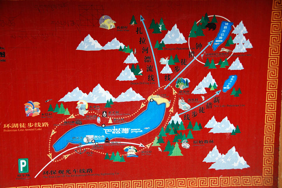
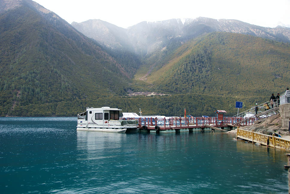
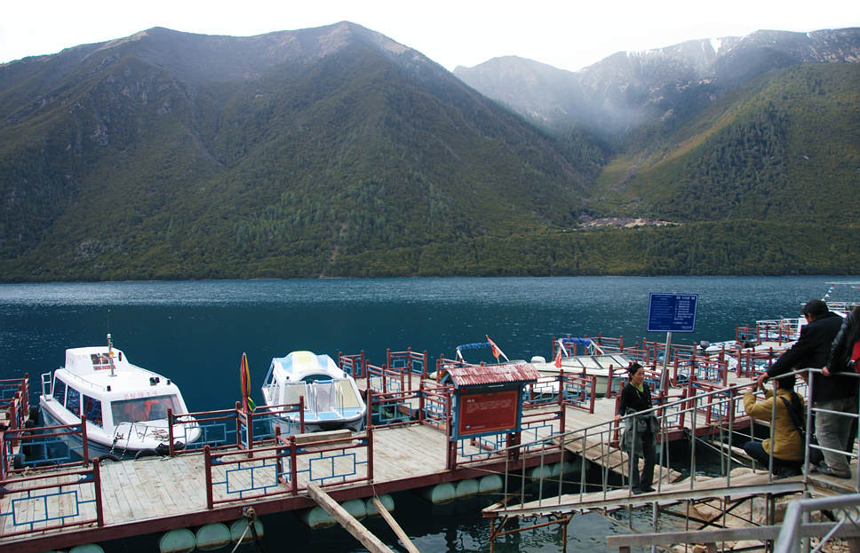
As with Grand Lake, one first meets the lake at its western end. As in Grand
Lake's olden days, the original road takes the northern side. There is a small
settlement at the west end with amazing views down the length of the lake
to the snowcapped peaks rising at the far end to the east. This is similar to
Judge Wescott's original layout for the development of Grand Lake City,
along our western shore; ask us for a map if you haven't spent time in that
original part of town. However, just as Grand Lake turned out, near the Tibetan lake,
development is now emphasized on the northern side. The cartoon map doesn't show
the new road to there. It does show how (as with Grand Lake) there is no road all the
way around the lake, but there is a dotted hiking trail. Development around the Tibetan
lake has never really gotten started and it is now very restricted; they do not want
lakefront homes, because they consider this to be a holy lake and they do not want
the environment to be disturbed. At the east end of the Tibetan lake are trails that
can lead to higher alpine lakes akin to the Lake Verna and Lone Pine Lake up the
East Inlet of Grand Lake.
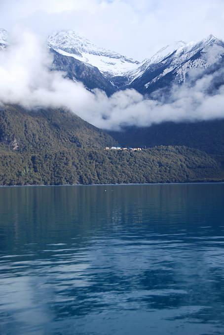
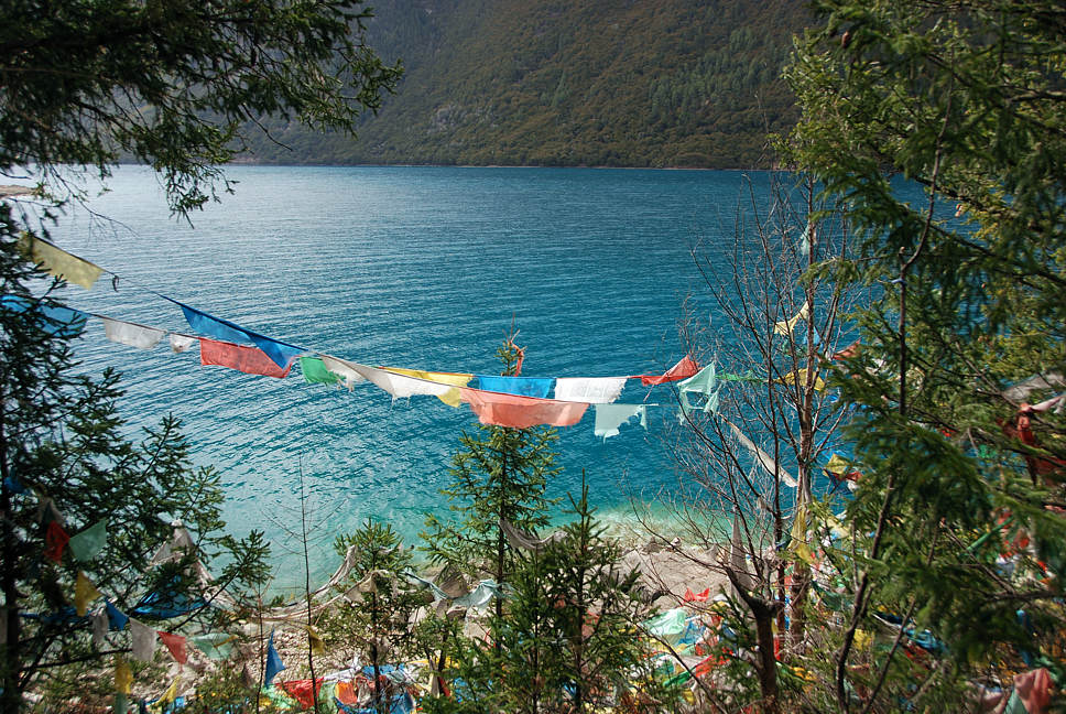
As with Grand Lake in its early days, one of the first things that strikes one about the lake
is its COLOR: blue/green, turquoise (shown at the top of this page). Hopefully the Tibetan
lake will be able to maintain its color. The Chinese however are adept at building tunnels,
so there is a high chance that the lake could have the equivalent of its own Big Thompson
Project performed on it. The engineering of downstream lakes akin to Shadow Mountain
Lake has already started.
Facilities at the lake are like the summer cabins of Grand Lake in the 1940's and 50's.
We arrived in early April, which was off-season. The lake was not frozen, although there
was a bit of snow in patches along its shore. During the night, fresh snow fell on the trees
several hundred feet above us. The heating for the lodging was less than minimal for comfort,
but then again, our cabin had probably not been heated for weeks before our arrival.
In Grand Lake's olden days, locals and visitors would come to town on the weekends to attend
the dances, specifically at the "Pine Cone Inn", by where Pancho & Lefty's is now.
The Tibetan lake has a similar party building with stage and dance floor.
In Tibetan, the name of this sister lake sounds like "Draksum-tso" (tso means lake).
Other pronunciations are Bagsum-tso and Pasum-tso. A Chinese might call it Basongcuo.
The natural lake's elevation is 11,380 feet, about 3,000 feet higher than Grand Lake.
Mountains near the lake rise to over 22,000 feet. Depth: we do not know. There is not
much to Google about the lake in English because the whole area has been mostly closed
off to foreigners.The latitude of the lake is about 29 degrees, making it as far south as
Cairo or Houston. Grand Lake is set at 40 degrees north. Very roughly, we can use a
Hopkins conversion formula that says that moving up a mountain 400 feet is equivalent
to moving northward one degree of latitude.
If Grand Lake were shifted 11 degrees southward to line up with Draksum-tso,
then to maintain the effects of Grand Lake's 8,369 foot elevation, one would have to raise it
4,400 feet (= 400 times 11). This would put Grand Lake at the lofty elevation
of 12,769 feet and partly account for why it freezes over and has a growing season
that is shorter than that of Draksum-tso. On the fifth page of this presentation,
we show a tree flowering in early April at Draksum-tso.
The elevation gain of the peaks around Draksum-tso is more than double what they are
around Grand Lake, and that is your Himalayan difference. Visitors are often struck by
seeing a magnificent peak topped with clouds and then later be awed by glimpses of an even more
lofty summit gleaming through s gap in the clouds several strata higher than one would think possible.
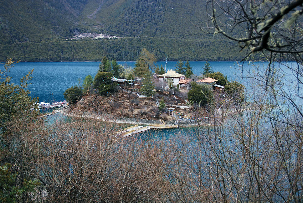
There is a marina at the Red Hat Monastery by the small island shown at the top
of this page. It did not appear as though boats were removed from the marina during
the winter. With the influx of Chinese tourists, it may be only a matter of time for the
lake's scenery to be punctuated with sailboats in the summer and for the lake to have
its own variation of Grand Lake's Lipton Cup and an annual regatta.
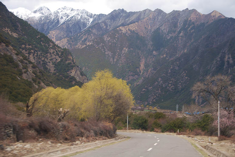
Further down are a few photos of the drive to Draksum-tso after we turned off the Friendship Highway.
To bypass all of this introduction, just click on a photo and you'll see the lake in one of its
visionary moods. Click again and you'll see the lake and its surroundings at dawn.
The drive off the Friendship Highway to the Lake is spectacular and will be even more
so when the new lakes flood the valley. We avoided the temptation to make many stops
so as to give us as much time as possible at our desired destination at the end, Draksum-tso.
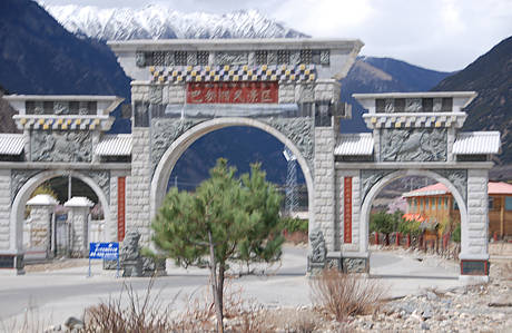
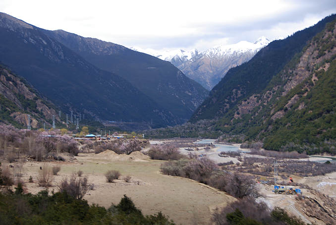
Scroll down for another view of the gateway leading up the valley.
The Chinese are renowned for making spectacular gates for
their communities, even this very small one that we have likened
to the town of Granby. Grand Lake has a bit of gateway with a
mountain man sculpture pointing the way into town and also the
Gateway Inn. Grand Lake is known as a gateway community to
Rocky Mountain National Park.
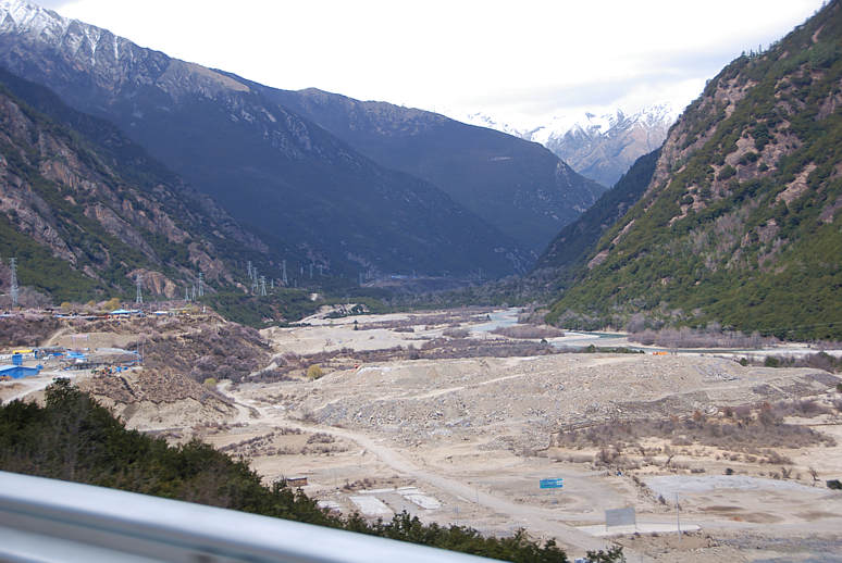
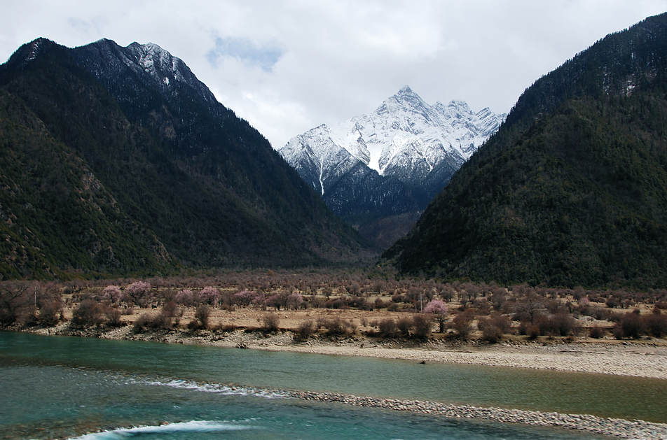
Here you can see where the valley is almost ready to be flooded.
This view is a bit reminiscent of meadow that is now below
Shadow Mountain Lake. The next time you come by our office,
stop in and ask to see the large photo of Shadow Mountain Lake
before it was flooded. (Note also the Big Thompson Project-
like power transmission lines running up the meadow.)
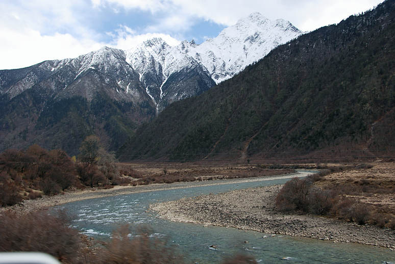
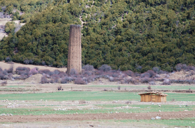
An ancient tower along the way, built for prestige, perhaps. Photos
above are a bit rushed, taken from a moving vehicle to save time.
When people visit Grand Lake from Granby or by descending through the
National Park in the summer, they too find many inviting stops along the way.
When they finally make it to Grand Lake, their time to explore the village and
the natural lake is greatly diminished from what they might have thought they
would have. As with the visitors to Grand Lake, visitors to Draksum-tso come
far with a full travel itinerary with not enough time to relax, explore and
soak in what the lake's unique setting has to offer.
(Of course, that's why we promote vacation homes).
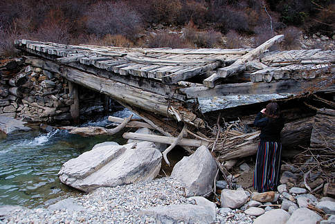
Ye old wagon bridge to the lake.
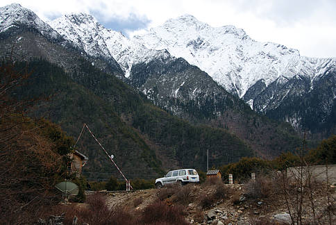
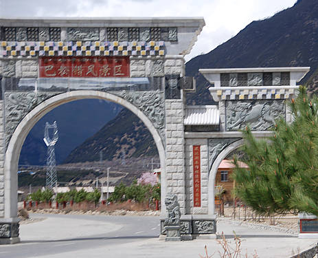
Final gate before reaching the lake. Click on the photo for late
evening views of Draksum-tso with snow swirling overhead.