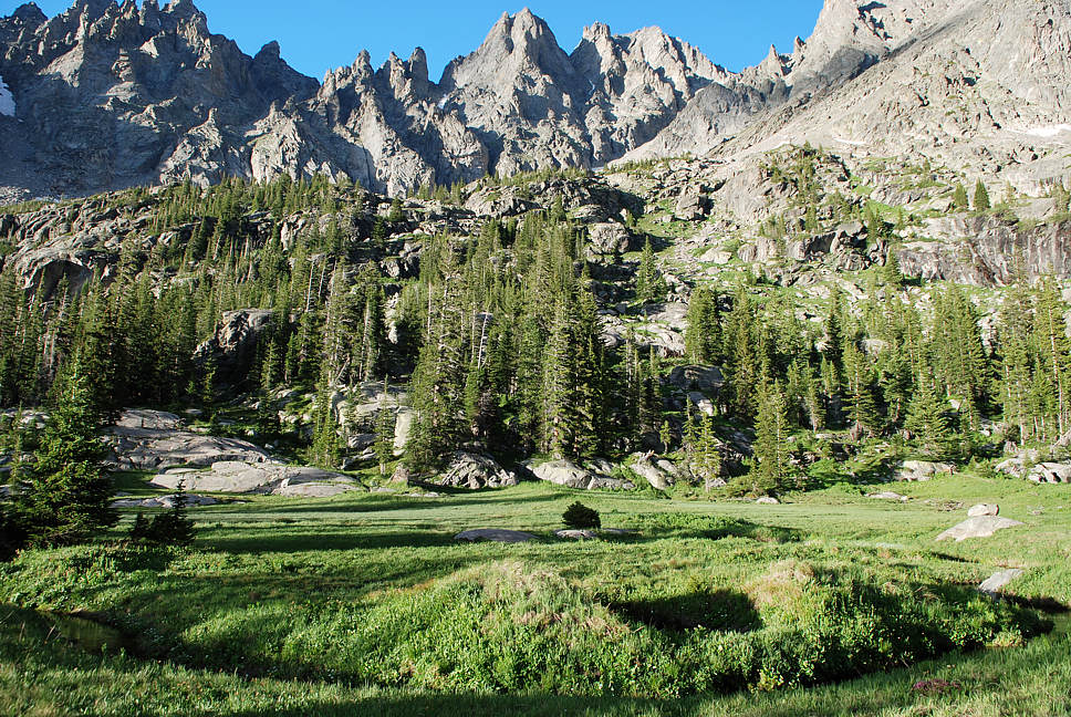
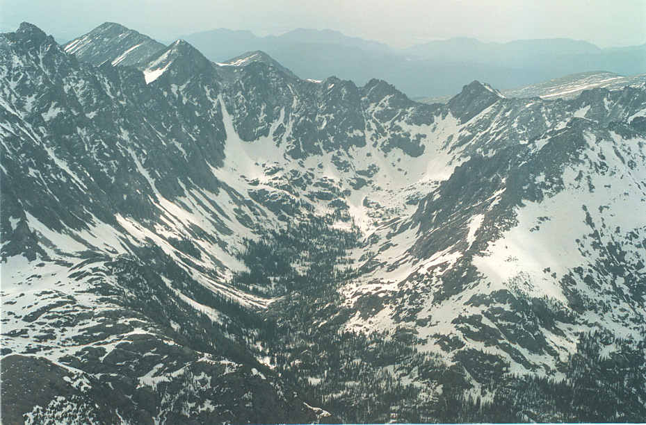
Here is a glimpse of where the trail ends; an alpine bowl that wraps 270 degrees around one's field of vision.
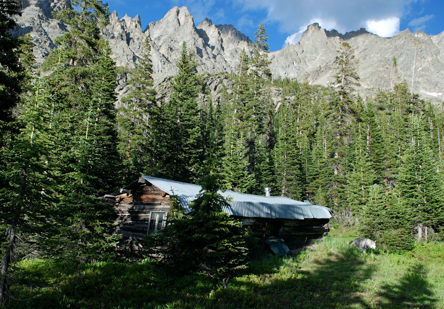
Scroll down to see the original cabin of prospector and trail builder Alfred T. Wheeler 1868-1938.
Scroll way down each page to not miss anything.
Here is a glimpse of where the trail ends; an alpine bowl
that wraps 270 degrees around one's field of vision.
Scroll down to see the original cabin of prospector and trail builder Alfred T. Wheeler 1868-1938.

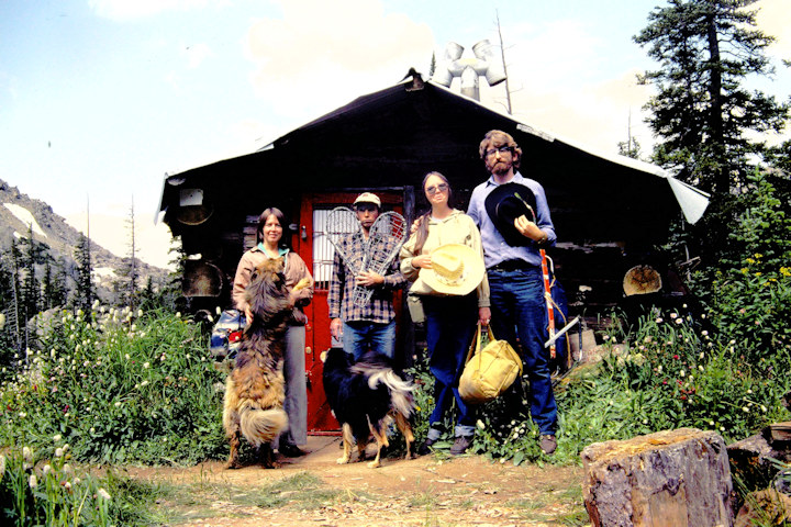
This webpage is a notice to prospective members for a company of nine (6 people, 2 dogs, 1 horse)
to join together for July 30, July 31, August 1, this year 2024.
One can live in Grand County for many years and still
not see or experience the finest it has to offer.
When Donna and I first came to Grand County, we had
acquaintances in Boulder who led us with pack animals
over Arapaho Pass into Coyote Valley where we would
then pick up a secret trail they maintained to Wheeler Basin.
You can find this basin on maps below the north face of
Arapaho Peak. These friends of ours come from the Wheeler clan
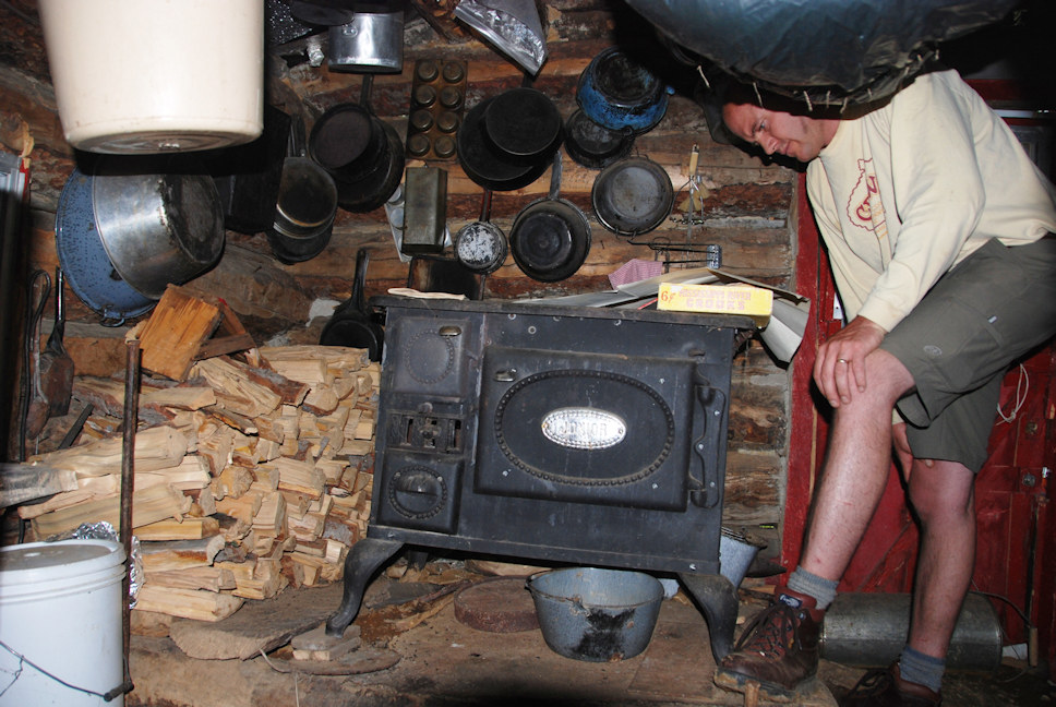
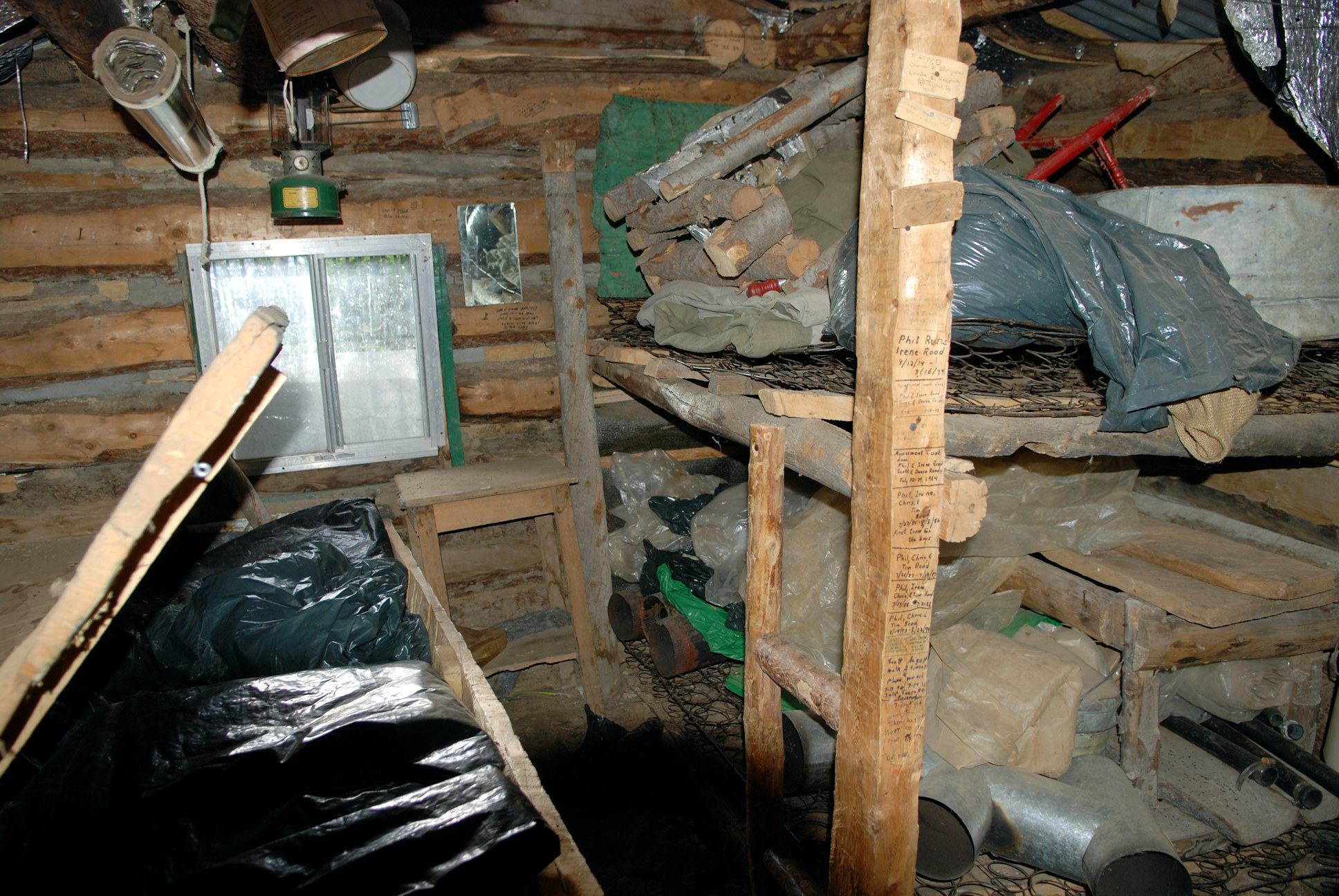
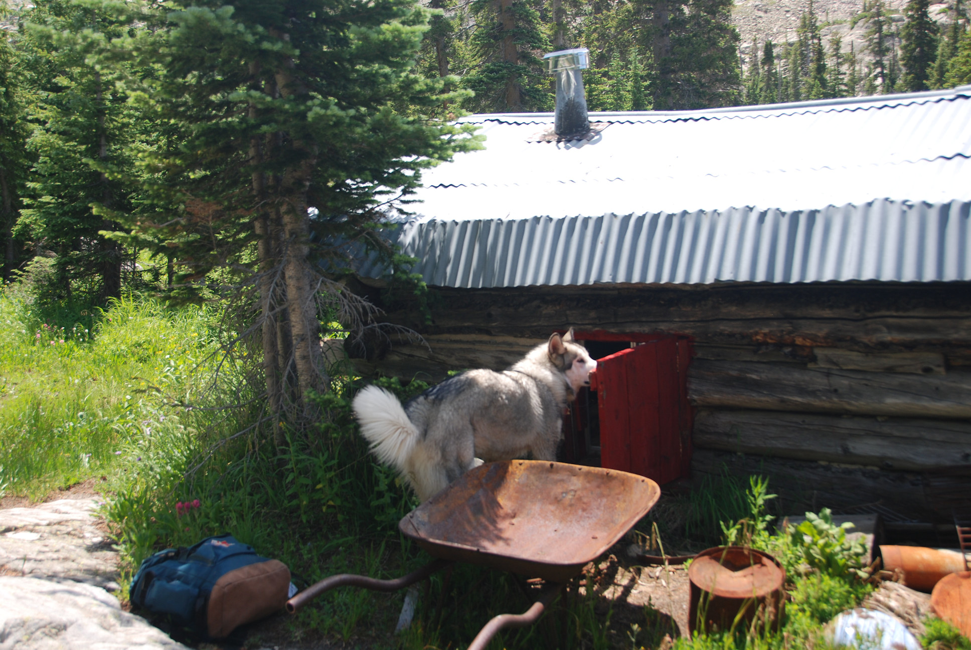
and know intimately of the log cabin with a tin roof deep in the basin.
Since the Indian Peaks has been declared wilderness, the cabin has been
locked up and abandoned by our Forest Service.
I am planning on an excursion, a wilderness trek on the last two days of July.
I have a permit for six people, one horse and two dogs to set up a base camp
in the lower part of Coyote Park, close to where the old trail leads to Wheeler Basin.
At this early stage I am not sure who will be in the company or whether we can have a horse for sure.
We need at least one pack animal to get us half way to set up a base camp.
Otherwise we will not have the energy to tackle the fallen timber and rock-slides
beyond our two day base camp to reach the cabin deep in Wheeler Basin.
We all get super busy in the peak of our short summer.
If you can't fit in the trip that's OK.
We can share our adventures with you later.
For a shorter trip, you could come up the Arapaho Trail to our base camp in Coyote Park.
I will be contacting various people to see if they can spare a horse and a wrangler
or help up in any other way. It takes some time to load horses into a trailer and then
drive to the trailhead, unload and park.
The original Alfred T. Wheeler called his basin "Garden of the Pinnacles."
He established an 80 acre placer claim and built the original switchbacks
descending into Grand County from the Boulder side.
Pack mules brought supplies to the cabin and then carried out
a curious clay made of glacial flower.
Trail maintenance required some effort. When the Wilderness act
outlawed chain saws and the Forest Service lost interest or memory of the Wheeler cabin,
the basin became closed off from the world.
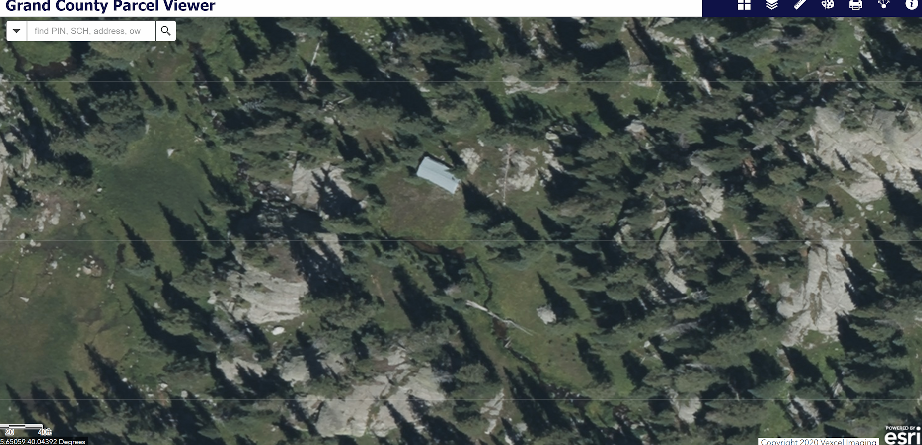
Does the cabin still stand in 2024 almost a hundred years after its creation with hand tools?
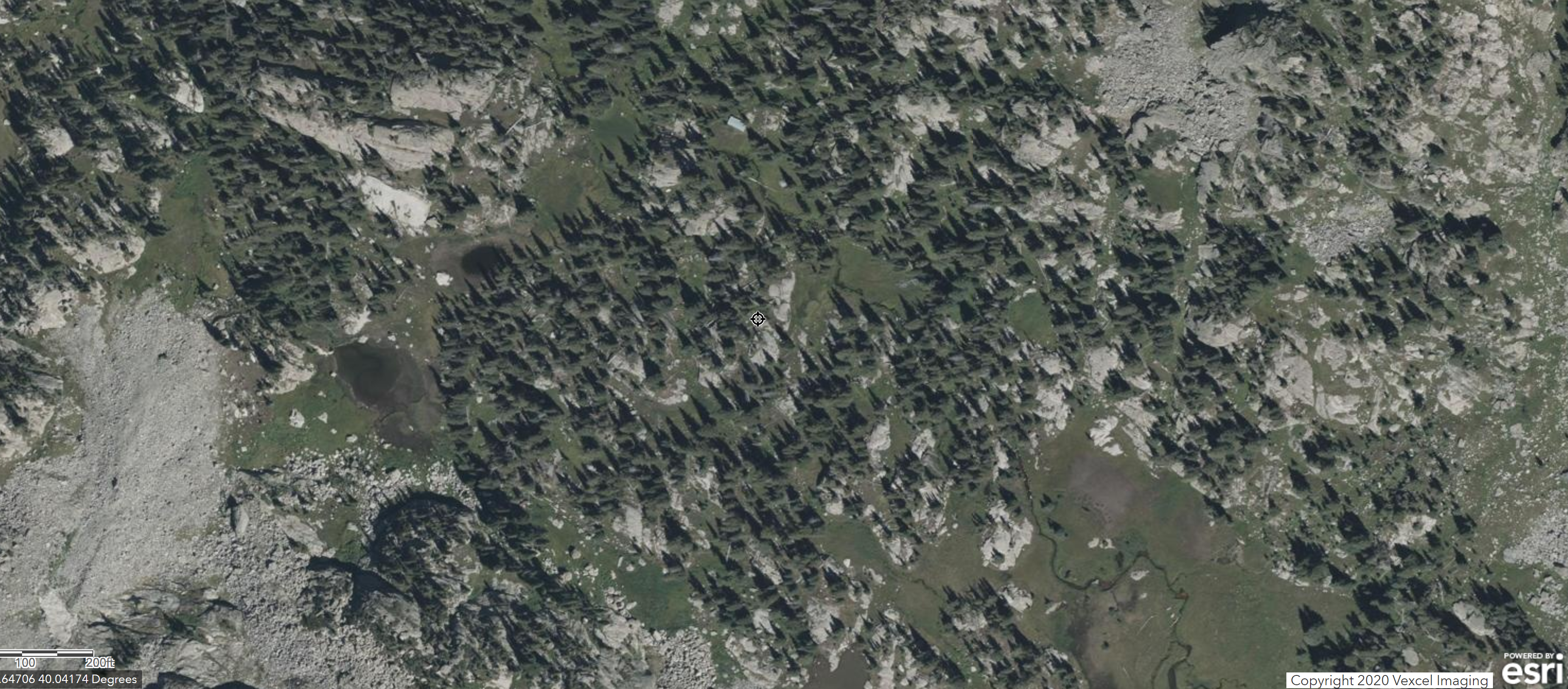
High resolution aerial views (from the Grand County assessor) show the entire tin roof intact.
Wheeler
Basin is marked on most maps of the Indian Peaks Wilderness. It is rimmed
within Grand County,
Colorado by Arapaho Peak, Arikaree, Navajo, Apache Peak and Mount George.
The basin is named in honor of the
original trailblazers to the area and a caretaker of the Silver Lakes region
at the top of
Boulder's pristine watershed.
Your virtual guide here has had the good fortune of meeting Mr.
Wheeler's children,
grandchildren and great grandchildren and has helped with a bit
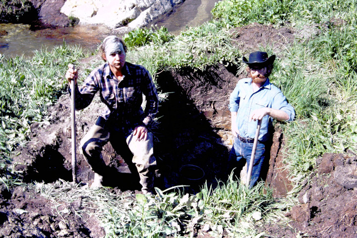
of the mining assessment work done on
Wheeler's 80 acre placer mine claim. A significant part of this
assessment work consisted in keeping a trail
open that a team of horses and mules could navigate to the remote
basin. When the Indian Peaks Wilderness
officially became a Wilderness in 1978, chainsaws were no longer
allowed to maintain trails. It was later
determined in court that Alfred Wheeler's claim no longer passed
the "prudent man" rule. His heir's ceased
doing trail work and visiting the area. Today (July of 2010),
after a great many storms and winters, the
original trail is mostly lost and its five bridges for strategic
crossing points of the creek coming out
of the basin are almost unrecognizable.
The splendor of the upper basin is still as powerful as before
(as you'll see in this photo presentation).
The towering forest in the lower Arapaho Pass trail is still very
impressive. The old way to Wheeler Basin
is now hidden by several tangled masses of forest that have been
felled by avalanches and the new more
vicious winds that intrude (for a complex nest of reasons, that
include the formation of Lake Granby,
the beetle kill of forests upwind, global and also solar
influences). The Forest Service has hardly
the resources today to maintain the Arapaho Pass Trail. This is
all sounding like the beginnings of
a western novel .... To speed things up, we are going to give you
a quick look at our latest photos
to the area. We can come back later and fill in with more
information including some GPS coordinates
for the lost bridges. For those familiar with Crater Lake and Lone
Eagle Peak (up the Buchanan and
Cascade Creek Trails), Wheeler Basin is on the other side of the
almost impassible rim south of
Crater Lake and the Fair Glacier.
For those familiar with the rugged Boulder side of the Divide,
Wheeler Basin is on the other
side of the glacier beyond the Green Lakes at the top of North
Boulder Creek. If you are crazy,
you can get in by taking the thousand foot rock chute to the south
of Arikaree Peak.
Click here to get started on the easiest way. Scroll down for a rare aerial view, two maps and more.
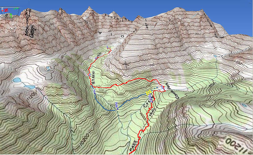
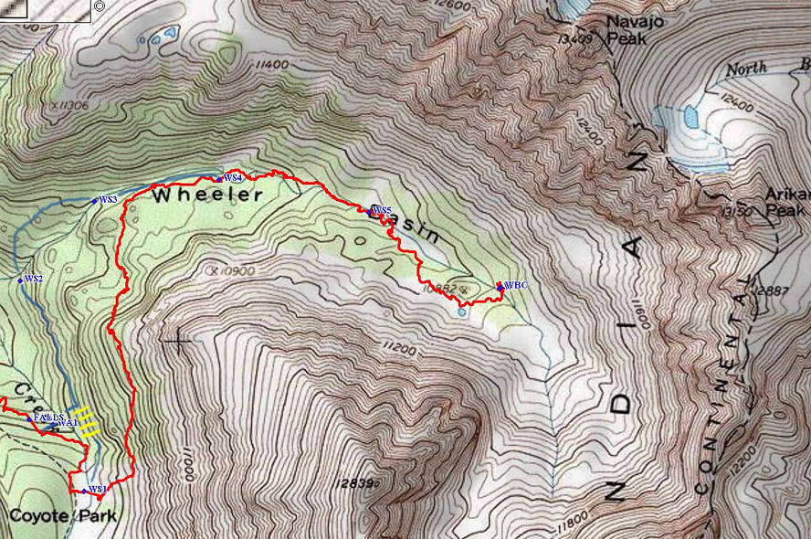
The two maps above are derived from the Monarch Lake quadrangle.
We are focusing here on just the
Wheeler Basin portion of the trek. To reach the trailhead, drive
along Lake Granby to its eastern most reach
to Arapaho Bay and then to Monarch Lake. Park and walk the
southern route around Monarch Lake to the
Arapaho Pass trail. It is nicely hidden upstream, just as you
cross the wooden bridge over Arapaho Creek.
We did this portion in the dark. About five miles up the trail
through a rich primordial forest, you reach
the confluence of two streams, one coming from Arapaho Pass and
Caribou Lake. The other and stronger
stream (to your left) is coming from Wheeler Basin and the north
face of 13,500' Arapaho Peak. Replenish
your water from that one. The red trail on the map is the route we
took going in according to our GPS.
The hand drawn deep-blue route is the way we came back out. The
blue route follows the original horse
and mule trail in and out of Wheeler Basin. The yellow slashes
added to the maps are where there is a
particularly nasty area of downed trees obliterating the original
trail. WS1, WS2, ...WS5 are five stream
crossings where there used to be bridges. The bridge is also out
at a lower stream crossing on Arapaho Pass
trail where the creeks from Wheeler Basin and Arapaho Pass come
together. You will not be able to get
in with a horse until a significant amount of new trail
maintenance is done. By foot, there is a shortcut that
one can take before one gets to the yellow slashes. A quarter mile
or so before Coyote Park, one watches
for where the stream makes a falls or rapids perpendicular to the
Arapaho Pass Trail. A little pass that
hazard one can make a beeline to the creek and within a couple
hundred yards from it find the original trail
close to where the yellow slashes are. You'll be almost right on
the 10,200 foot contour line. From there,
the trial heads NNW to the stream crossing labeled WS2. Here are
the secret coordinates for where to
say farewell to the Arapaho Pass Trail and bypass a lot of fallen
timber: North 40º 2.31' West 105º 40.40'.
If you loose your way, here are coordinates to WS2: North 40º
2.64' West 105º 40.50'.
It is worth noting that in the towering forests, our fancy GPS
could not always get a signal,
and this was on a clear day! Good luck. Stick together. If you are
going to be lost,
do so as a group. This is big and deep country with visibility
restricted to 30 yards in many places.
Hikers from Boulder can get to Wheeler Basin by starting at the
4th of July Campground and coming up
and over Arapaho Pass and down the switchbacks that Alfred Wheeler
and his friends originally built.
One slowly descends into Coyote Park and continues all the way
down Coyote Park before making the
crossing of Arapaho Creek to start on The Basin Trail, or what one
can find of it. The red route shown
on the maps around a shoulder of Arapaho Peak is just a game
trail.
For
yet another way to get to Coyote Park, this time from Meadow
Creek Reservoir and the
Caribou Trail, click on the following presentation (use your
back button to return to here).
 Click here to get started on the easiest way!!!
Additional historical information is provided below.
* Our old library link had text with important names and dates copied as follows:
14 photographs (13 views)
Contents Photo 1 - Cabin at the Wheeler claim. 1915
Photo 2 - Close-up view of the cabin. 1915
Photo 3 - A. T. Wheeler and an unidentified man. Beaver in the
foreground.
Photo 4 - Wheeler Basin, over the range. Irene and A. T. Wheeler
on a rock outcropping. 1905-1915.
Photo 5 - Joe Davis, A. T. Wheeler, and Jim Bennett with the first
load of clay.
Photo 6 - Looking in Wheeler Basin above Snaggle-tooth slide,
other side of continental divide from Silver Lake. 1916
Photo 7 - First clay pit at Wheeler Basin. 1915
Photo 8 - Cairn in left middle foreground, corner marker of the
Wheeler claim. Arikaree Peak is in the background. 1915
Photo 9 - Indian Peaks from the clay pits on the Wheeler claim in
Wheeler basin. The clay was used for medicinal purposes; used by
the Rexall Company for "60 kinds of medication". 1915
Photo 10 - Lake Basin, above Wheeler Basin, in Grand County. Lake
Oletha, named for Oletha Wheeler. 1915
Photo 11 - Top of Arapaho Pass. The first load of clay out the
Wheeler claim. Joe Davis, James R. Bennett, and a third man
(possibly "Mr. Swihart") with pack mules. (Very similar to Photo
5. Not scanned.)
Photo 12 - Wheeler Basin. (Poor quality image. Not scanned.)
Photo 13 - Lake Beth, in Wheeler Basin, named for Rena Beth
Wheeler, who is in the foreground. 1921 (Poor quality print. Not
scanned.)
Views taken at Wheeler Basin, including Wheeler claim (a clay pit
of medicinal clay), a log cabin, Lake Beth (named for Rena Beth
Wheeler Lederer), and Lake Oletha (named for Oletha Wheeler Barr).
Wheeler Basin is in Grand County, Colo.
Terms Of Use: Restrictions applying to the use or reproduction of
images are available from the Carnegie Branch Library for Local
History/Boulder Public Library.
Personal Names:
Bennett, James.
Swihart, Mr.
Wheeler, Alfred T., 1868-1938.
Wheeler, Lillian Irene Van Horn, 1871-1935.
Lederer, Rena Beth Wheeler, 1907-
Davis, Joseph A., 1855-1931.
Subject: Beavers -- Colorado -- Grand County.
Log cabins -- Colorado -- Grand County.
Clay -- Colorado -- Grand County -- Therapeutic use.
Lakes -- Colorado -- Grand County.
Donkeys -- Colorado -- Grand County.
Geography Lake Beth (Colo.)
Snaggletooth Slide (Colo.)
Arapaho Pass (Colo.)
Indian Peaks Wilderness (Colo.)
Wheeler Basin (Colo.)
Arikeree Peak (Colo.)
Lake Oletha (Colo.)
Rocky Mountains.
Genre/Format Photographs.
Neg. #1804.
LOCATION: BCARN Documents Room
CALL #: 513-2-21 PHOTO
Also of relevance from the Boulder Library WAS the following link:
Andrews,
Darwin. Collection 538
This collection contains photographs of wildflowers, trees and
other plants arranged alphabetically by botanical plant name.
Views of Colorado mountains and lakes and other geographical
features are arranged by location into Boulder, Boulder County,
Colorado and miscellaneous views. Photographs of Rockmont Nursery
and the Darwin Andrews family, in-laws and relatives are also
included.
Photographs of snapshot quality taken by Darwin Andrews [see
biography below] of wildflowers, plants and trees native to the
Rocky Mountain region. Some of these photos were used to
illustrate his Rockmont Nursery seed catalogs. Collection also
includes views of Rockmont Nursery, Boulder, Boulder County and
surrounding regions as well as family photographs of the Darwin
Andrews family, Samuel R. Wheeler family, relatives and friends.
There is also an oversize portrait of Herbert N. Wheeler located
in 538-O-1. Wheeler was the son of Rev. Samuel Wheeler, the first
pastor of Boulder's Seventh Day Baptist Church, and the
co-discoverer (with Darwin Andrews, a brother-in-law) that the ice
mass on Arapaho Peak was indeed a glacier.
Darwin Andrews was a horticulturist and the owner of Rockmont
Nursery from approximately 1899-1937. Rockmont Nursery was located
in Boulder on the corner of 23rd Street and Bluebell. Andrews
specialized in collecting and cultivating native plants from the
Rocky Mountain region. He ran a world-wide mail order business
selling native plants and wildflower seeds.
from:
http://boulderlibrary.org/carnegie/collections/photographs.html
..
![]()
 Click here to start the journey on the Arapaho Trail a little above Monarch Lake, east of Lake Granby.