Scroll down the map to see two clusters of land that are for sale. The 32 lots
for $299,000 are shaded in yellow. The 17 lots shaded in pink are only $139,000.
Only a few of the roads in this map are actually in. Scroll below the map for details.
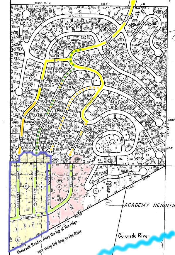
The easiest way in with the fewest hills is via the road, Kessel's Terrace, dotted in green.
Click on map for topo maps of the lower portion of the map. Scroll down for much more.
The 32 lots for sale are shaded in light yellow. Lake Granby, a boat ramp and the road to
Continental Divide trails are just a short ways beyond the top of the map. Highway 34
is to the upper left. Snow removal has been done on the yellow portions of the main
road going in. In the summer, the orange portion is driveable. The dotted orange roads
are just barely roughed in. None of the roads touching the 32 lots are in. Scroll down
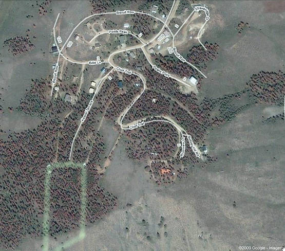
for some Google Earth views with the trapezoid around the 32 lots highlighted.
Scroll down to see more to the south, including the Colorado River.
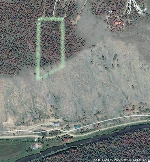
Click on the satellite views for topo maps of the undeveloped area for sale.
Notice the Colorado River at the bottom of the satellite view and the
steep south-facing ridge plunging over 400 feet down to the river.
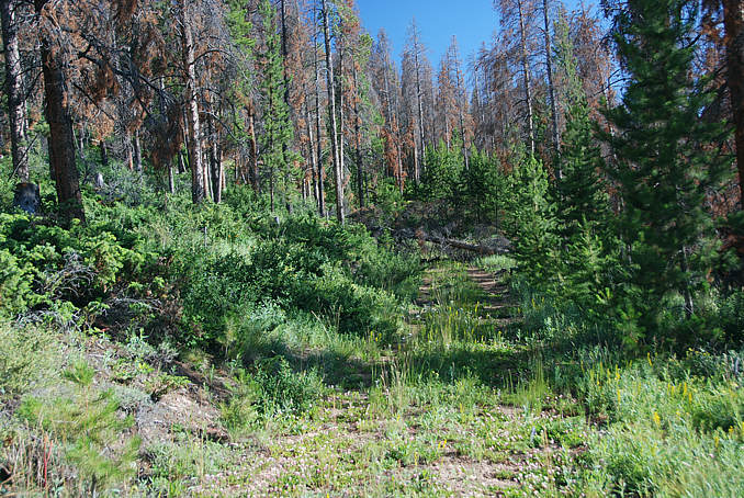
This is looking to the end of the access road called Kessel's Terrace; it is the easiest way
in to area with a minimum of hills. On the map at top it is dotted in green.
Click on photo for topo maps of the areas and GPS coordinates.
..
.. return to list ..