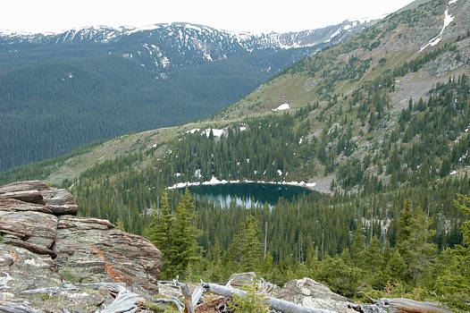
Click on photo to continue on down and onto the Blue Lake trail.
From here it is a steep descent through a forest to Blue Lake. The trails
above and near Blue Lake are almost gone. There is a lot of avalanche
rubbble near the lake. The best way to find the upper trails is to start where
the water flows out of the lake and follow it downstream for about 200 feet.
You will then find the old trails that can lead you to higher ground from there.
There is a trail junction near the following location N40º 21.227 W105º 55.203.
It can be hard to notice. One trail will take you towards Mineral Point. The
other one will lead you to the high upper meadow below Bowen Mountain
that we showed here.
.. return to Scenery2 page ..