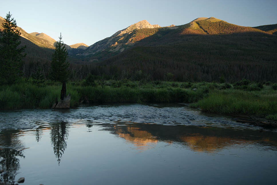
Click on photo to cross the river and journey into the rich forest. This long day hike takes one
to a gorgeous valley behind the Never Summer Mountains. From Trail Ridge Road in Rocky
Mountain National Park, the rugged and snowy east faces of the Never Summer Mountains may
not look like a promising area for there to be a verdant two-mile-long valley gently rising to
timberline. And yet, that is exactly what one can experience on the backside of Mount Baker
and the high peaks named after clouds. Most of this journey is in National Forest land. The map
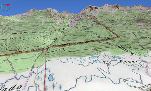
directly below (and the image above) shows the groove into "Baker Gulch". The beginning of
the trail is a parking area and bridge by the Colorado River. The turnoff from Trail Ridge Road
Highway 34 says National Forest access, Bowen and Baker Gulch. This is about 7 miles up from
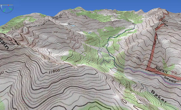
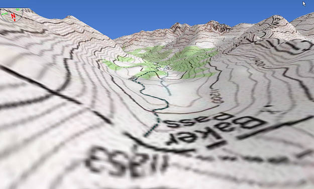
the Grand Lake side of the entrance into The Park. The Baker Gulch route to Baker Pass, slowly
makes it way up through a deep forest to the Grand Ditch. This water diversion makes a scar
across the Never Summers at a high contour line at over 10,200 feet. Behind the Historic Holzwarth
Ranch, there is a hidden access road to the ditch that one can use to hike up to the Grand Ditch
or to use an alternate route for coming back down. With two cars, one can park one at the river
bridge and the other one at the Holzwarth Ranch (about a mile apart). If you come back down
via the Grand Ditch access road, you might have cell phone coverage for part of your descent
to let someone know where you are. There is also a completely different access route, starting
from Rand, Colorado on the far west side of the Never Summer Mountains. We will post more
about that route next year, after we are able to double check on the condition of the roads and
trails. We tried to do it this year, but there was not enough time to work it out and see if offroad
vehicles would be helpful. On the hike featured here, we did meet an individual at Baker Pass
who had come via Rand and over the 12,200' ridge at Parika Pass. This was in mid-August when
there was not much snow on the Jack Park Trail. Late August and September is the beginning of
hunting season. If you come in via Rand in September, you are going to meet hunters. If you
start off in early July, you will probably encounter deep snow near Parika Lake and Baker Pass.